Lead: Stephen Ackley, Dr. Alberto Mestas-Nuñez, and Dr. Son Nghiem
Snow and ice processes and properties are found to impact both the fundamental working of the earth system and also present operational challenges to the functioning of human society. Sea ice changes have profound consequences that resonate across multiple scales, from weather to local ecosystems and other polar resources. Sea ice has retreated in the Arctic and is predicted to further retreat this century in both the Southern and Northern Hemispheres. Winter cold air outbreaks in the U.S. such as the Feb 2021 "Big Freeze" in Texas, have already been found to be connected to the recent Arctic sea ice retreat. Ice sheet melt currently represents the newest significant contributor and accounts for the acceleration of global sea level rise since 2000. Sea level rise poses a major socioeconomic threat to the U.S. and other nations worldwide, with current estimated infrastructure costs associated with even a meter increase in sea level estimated to exceed more than one trillion dollars (Anthoff et al., 2009). Hailstorms in the US impact regularly the regions from North Dakota to Texas with annual costs exceeding all other extreme storms combined in most years.
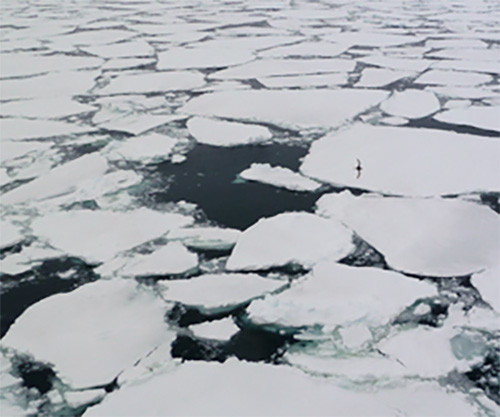
Arctic and Antarctic Sea Ice
The polar pack ice regions are highly sensitive to winds, air temperature, ocean temperature, salinity, and ocean currents. Remote sensing data are essential for detecting large scale changes in sea ice concentration, extent of the ice edge, and ice thickness. However, ice characteristics from space have shown weak correlation with ship-based observations, both for ice concentration (Knuth and Ackley, 2006) and ice extent (Worby and Comiso, 2004). While satellite, airborne and ship-based remote sensing has played a crucial role in monitoring the vast and inhospitable polar regions, proper interpretation requires in-situ measurements to validate the satellite data. A unique aspect of our work is data from ship-based field programs on Arctic and Antarctic sea ice (sponsored by ONR and NSF), where we have obtained wide-ranging data on sea ice that provide calibration/validation sets for use in improving remote sensing analyses of sea ice, as well as application to science questions using these data.
Center students are trained in using data from satellites, aircraft, remote buoys, and sea ice cores data for studying sea ice in connection with current unprecedented changes in Arctic sea ice and potential changes in Antarctic sea ice. Students analyze these datasets, particularly in the Antarctic, using data from radar, altimetric and visible satellite and airborne sensors and measurement on sea ice cores using analyses of stable isotopes, ice structure and physical properties.
Ice Sheets, Glaciers, and Sea Level
Recent analyses of data from multiple satellite missions indicate that both the Greenland and Antarctic ice sheets are losing mass and contributing to sea level rise. Existing satellite missions have been somewhat effective in identifying and monitoring changes to the ice sheets, as well as generating some of the inputs needed by ice sheet models. More recent changes since 2009 (when the first ICESat failed) until present, however, have been poorly documented. To develop more comprehensive and accurate models, satellite observations must be complemented and supplemented by detailed in-situ measurements.
Center students are involved in research to process and analyze satellite data (CryoSat-2, ICESat-2), and to assess glacier and ice sheet stability for the ice sheets of Greenland and Antarctica.

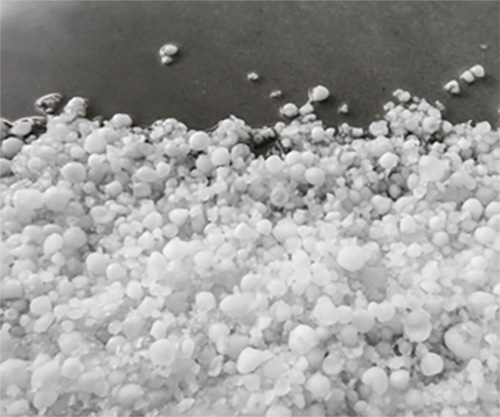
Physical and Geochemical Properties of Hail
Hail storms, extreme events that accompany severe thunderstorm outbreaks associated with mesoscale convective complexes, are the major cause of property damage losses in the United States, exceeding the financial losses of hurricanes, tornadoes, and fires. Recent work at The University of Texas at San Antonio has developed methodologies to examine the structure and geochemistry of collected hailstones, offering the potential of identifying the mesoscale atmospheric structure of hailstorm events. An extensive collection of two hundred hailstones from several storms in Texas are now available for study.
Center students are involved in continuing research in the physical and geochemical properties of collected hailstones and relating these properties to the atmospheric temperature structure of where the hailstones formed, computations of the updraft velocities in the storms, and the source regions within the storm of the initial formation of the hailstones. Exploratory analyses is conducted on the presence of microplastics and microbiology in the hailstones.

Virtual Tour: Snow & Ice Geophysical Lab


