Aerodynamics Facilities
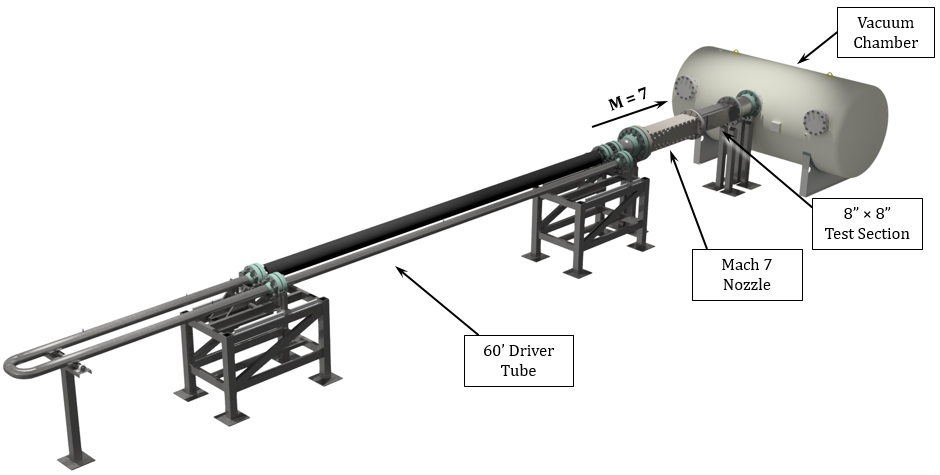
Mach 7 Wind Tunnel

- Ludwieg Tube Facility
- M = 7
- Re = 0.5–50 x 106 m-1
- Test Section = 8" x 8" (square)
- To = 700 K
- Test Time = 70 ms (x 4 per burst)
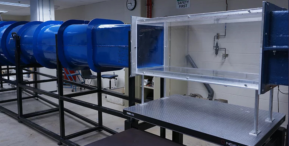
Low-Speed Wind Tunnel

- Open Loop Blowdown Facility
- Freestream Velocity = 40 m/s
- Test Section = 1.5' x 1.5' (square)
- Free Stream Turbulence < 0.3%
Measurement Equipment
- High-Speed Photron SA-Z Camera (20kHz–1MHz)
- LaVision IRO Image Intensifier
- Spectral Energies Burst-Mode Laser (1kHz–1MHz)
- Litron 15Hz PIV Laser
- LaVision 15Hz Stereo PIV System
- Sirah Dye Laser
- Excimer Laser
- FLIR IR Cameras
- Kulites, Thermocouples, and assorted Pressure Transducers
- Capability for integration of force/moment balances
Remote Sensing, GIS, Geophysical Facility
Equipment
| Item | Quantity |
|---|---|
| computers and workstations | 38 |
| data and image server (20TB) | 1 |
| electromagnetic induction meters (GSSI, Geonics) | 3 |
| FM-CW snow radar system (customized) | 1 |
| ground penetrating radar system (GSSI) | 1 |
| plotter | 1 |
| printer | 2 |
| rain gauge (tipping bucket) | 8 |
| scanner | 1 |
| SEA EXPLORER glider (ALSEAMAR) | 1 |
| spectroradiometer (ASD FR) | 1 |
| terrestrial LiDAR scanner (Riegl VS-1000) | 1 |
| thermal imaging camera (FLIR) | 1 |
| Underway ice camera system (EISCam) | 1 |
Software Resources
| Software | Site Licenses |
|---|---|
| Ecognition | 3 |
| ENVI/IDL | 25 |
| Erdas Imagine | 5 |
| ESRI ArcGIS | site |
| FLAASH | 3 |
| MATLAB | site |

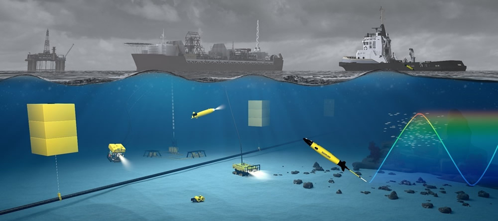
SEA EXPLORER Underwater Glider — watch SEA EXPLORER video
Turbulence, Sensing, and Intelligent Systems
Himalaya Supercomputing Cluster
A dedicated cluster at The University of Texas at San Antonio consisting of 48-node quad-core computing cluster mainly used for code development, validation and optimization tasks.
The University of Texas at San Antonio Simulator NVIDIA Graphical Cluster
High performance simulations are conducted based on clusters based on CUDA architecture and with at least teraflop of peak performance. The system consists of 8*16GB DRx4 ECC, 4 NVIDIA Tesla K-80 units, 2x2TB SATA hard drives, 1x120GB SATA 2.5" solid state drives, and 2x12-16 core Intel Xeon 2.6gHZ with 3 year replacement warranty.
Mobile Sensing
The laboratory is equipped with wind, temperature, and surface flux and gas sensors to be mounted on mobile tripods. Additional mobile sensing is obtained by mounting sensors on unmanned aerial vehicles. A cooperative fleet of 6 automated unmanned aerial vehicles (UAV) with the following specification are used:
- Quad-Rotor: +4, x4
- Hex-Rotor: +6, x6, Y6, Rev Y6
- Octo-Rotor: +8, x8, V8
- supported ESC output: 400Hz refresh frequency
- supported transmitter for built-in receiver: Futaba FASST series and DJI DESST series
- supported external receiver: Futaba S-Bus, S-Bus2, DSM2
- recommended battery: 2S~6S LiPo
- operating temperature: -5°C to +60°C
- assistant software system requirement: Windows XP SP3 / 7 / 8 (32 or 64 bit)
- other DJI products supported: Z15, H3-2D, iOSD, 2.4G Data Link, S800 EVO
In-House Models
Weather-Research-Forecast (WRF)–Plume: The existing WRF model has been modified and a new plume module has been implemented. The plume modules solves an additional turbulent transport equation using nested grids within a Large-Eddy-Simulation (LES) framework. The version is now available for testing.
Data Downloads: A 12km and 4km resolution simulation Atmospheric Boundary Layer (ABL) data in the regions of (a) Texas, (b) Iowa, (c) Idaho, (d) Gulf of Mexico Region, (e) Florida, (f) California coasts, and (g) Atlantic coast is available for download.
Density Currents on Sloping Region: An in-house LES model has been developed to model density currents over sloping rough-bottom and is available for download for research purposes.
Direct Numerical Simulation (DNS) of Flow over Roughness: An immersed boundary method based DNS solver has been developed. The high Re data for uniform and irregular roughness is available for download.
Other Computational Resources
The University of Texas at San Antonio
The University of Texas at San Antonio's University Technology Solutions (UTS) maintains and supports an on-campus high-performance computing cluster.
Learn more about the high-performance computing clusterTexas Advanced Computing Center (TACC)
The UT System Research Cyberinfrastructure (UTRC) program provides researchers at all UT System institutions access to advanced computing capabilities at TACC. TACC resources available through UTRC include: high performance computers, large data storage, high bandwidth data access, extensive software library, training support, and computational expertise.
Learn more about the TACC

